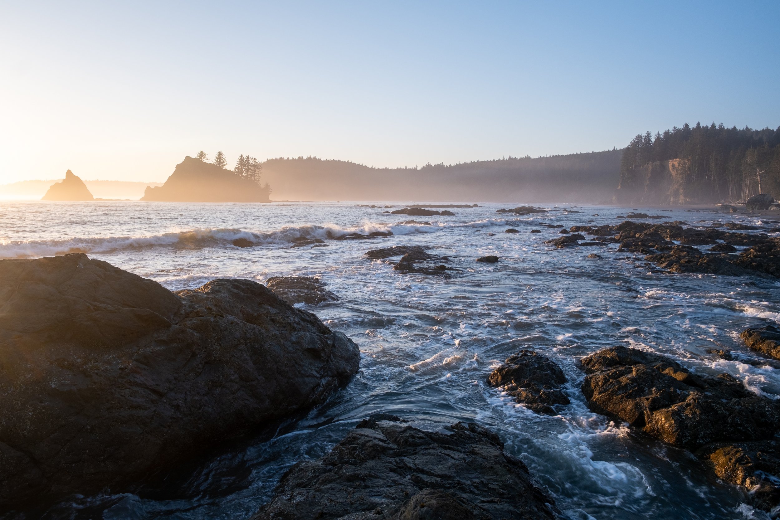
Hey folks, I’m working through a backlog of photos and trip reports here, so apologies for the delay!
June 19-22 Matt, Eric, and I headed into the Northern Pickets for four days, approaching via Hannegan Pass and Easy Ridge, and tagging Easy Peak, Whatcom, West Challenger, Challenger, East Fury, and Luna as we made our way through the area, exiting via Access Creek and taking the Water Taxi back to Ross Dam. It was an amazing trip in the biggest part of the North Cascades that I hadn’t yet visited—I’ve been meaning to get into the Pickets for years, and with fire and trail closures, it took until now to make it happen! And the with the currently burning Luna Fire which started just 2 days after we left, we may have gotten lucky with the timing 🥶
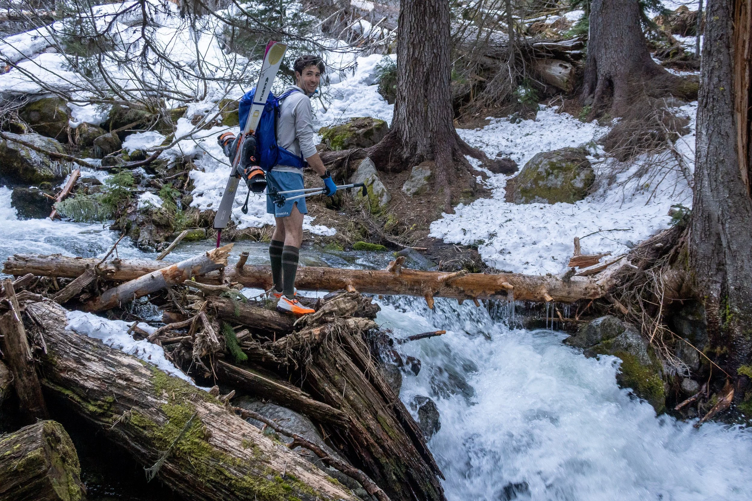
Day 1: After dropping cars at the Ross Dam trailhead the night before, we drove the long way around to the Hannegan Pass trailhead, and set off at 10am. There was just a few tiny snow patches remaining on the trail at Hannegan Pass, and before long we were scuttling down to the bank of the Chilliwack River and wading across.
Wading across the Chilliwack River
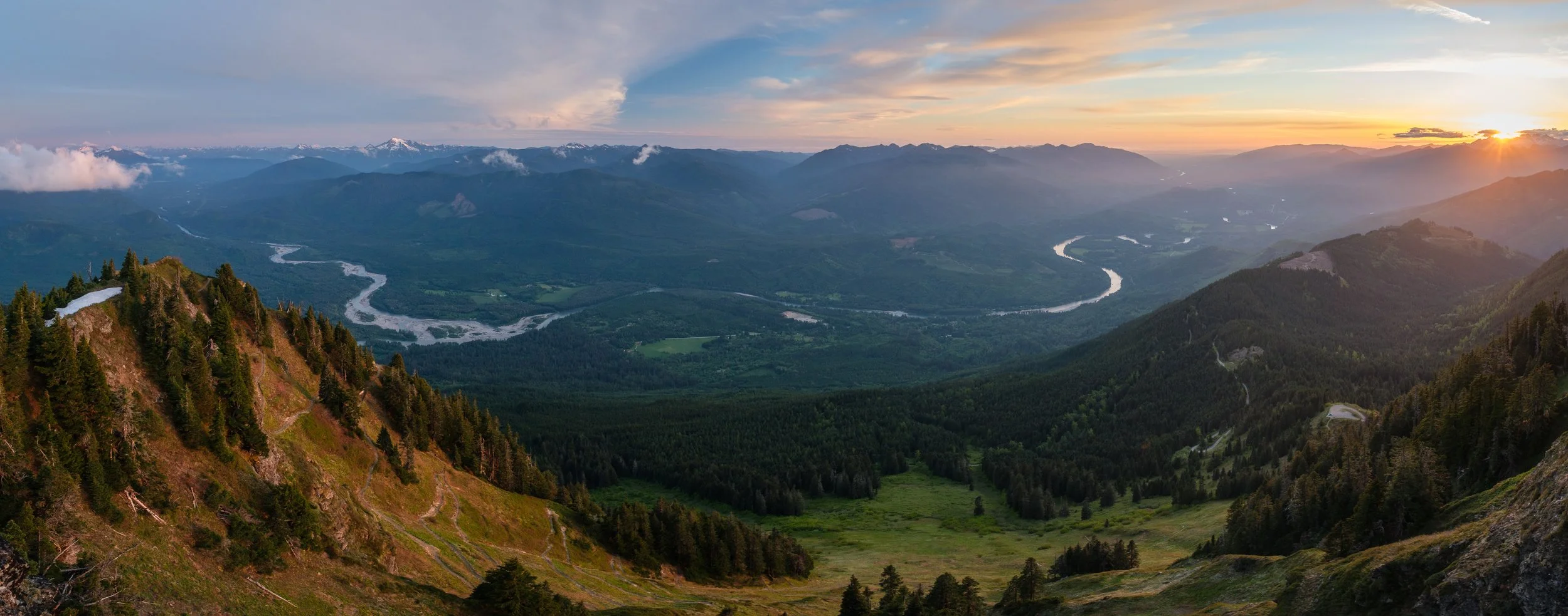
We picked up the abandoned trail up Easy Ridge without too much trouble, and followed it easily up to treeline, then headed along patchy snow to the top of Easy Peak. The views kept getting better as we went, with Whatcom looming over us by the end of the ridge, and Blum, Shuksan, and Baker to the west. We dropped down easy snow around the SE buttress of Whatcom, we encountered our first real challenge: the Imperfect Impasse, which really lives up to its name. It’s a deep gash running down the hillside, up to fifty feet deep in places, with nearly vertical sides. Best of all, it was almost completely invisible until we were right on top of it. With a bit of care we were able to downclimb into the bottom of the Impasse and scramble out the far side. Late in the day, the last thousand feet of climbing up to Perfect Pass felt long, but we found a nice campsite and enjoyed watching the sunset.
Eric and Matt boot ski-racing down from Easy Peak, with the Challenger Glacier in the upper left.
Matt downclimbing into the Imperfect Impasse. Blum at upper right.
Evening light on Baker (left) and Shuksan (right) with Mineral Mountain lower in front.
Day 2: We slept in a bit before heading up to tag Whatcom via easy snow on its south side, then a short bit of fun easy scrambling to the east to reach the true summit, with great views down towards Whatcom Pass. We zipped down the snow back to camp at Perfect Pass, then packed up and headed off at 10am to bag West and Main Challenger. It was easy going up the Challenger Glacier (we opted not to rope up) to Solar Pass (7,600 foot pass west of West Challenger) where we dropped packs and wrapped around onto the south side, dropping 50 feet. We climbed snow and some ungodly chossy rock to the notch immediately west of West Challenger, then 5 minutes of easier and cleaner scrambling brought us to the summit of West Challenger (~1.5 hrs from Perfect Pass, 50 mins round trip from Solar Pass).
Heading off towards Whatcom from Perfect Pass
Matt reaching the ridge crest just below the true summit of Whatcom. False (SW) summit in background.
Heading away from Whatcom and Perfect Pass onto the Challenger Glacier.
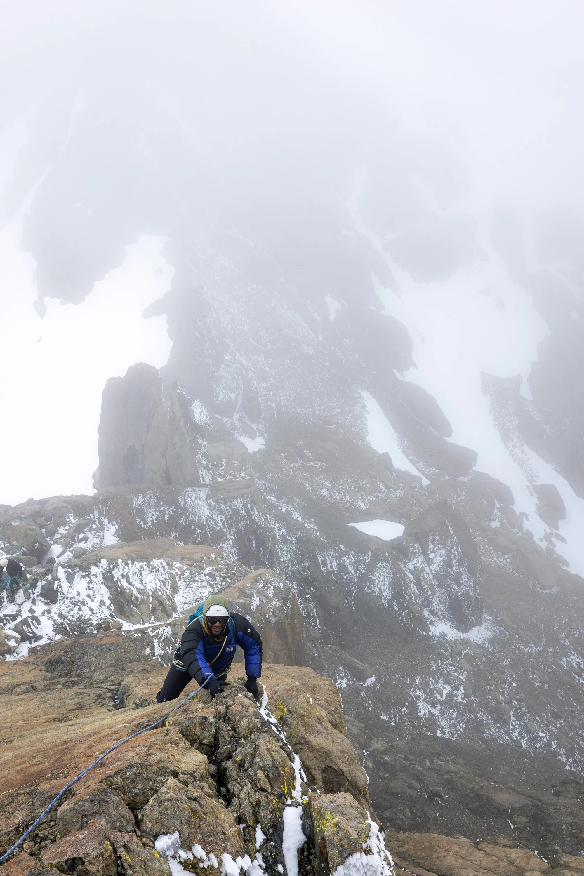
Matt and Eric climbing choss to reach the notch immediately west of West Challenger. “This is perhaps the chossiest choss I have ever experienced” said Eric. Whatcom in background (and Slesse!)
We retrieved our packs at Solar Pass and continued across the Challenger Glacier, making a gentle traverse around 7,400 feet to reach Challenger Arm. We headed up easy snow until a few hundred feet below the summit, then grabbed harnesses and backpacked the rope for the last climb, with stunning views down into the Luna Creek cirque. The climbing was fun and easy with only 1-2 moves which we opted to rappel (20 meter rope would be fine) on the descent. We retrieved packs and headed down Challenger Arm to 7,000 feet, then cranked right and cruised down mushy snow as we picked our way towards the valley bottom. We only did a little bit of easy slab downclimbing, and, with some care, had no trouble, but a little later in the season (with less snow) I think this would be more tedious. A healthy amount of talus hopping in the valley bottom brought us to the last easy climb up to Luna Lake just over 3 hours after retrieving packs below Challenger. We had plenty of daylight left, but opted to camp at Luna Lake, where Matt kept himself entertained by fishing for icebergs in the outlet creek. Really a stunning place to camp.
Eric hopping over a small crack on the Challenger Glacier as we traversed over towards Challenger Arm
Rappelling of the summit block on Challenger
Matt fishing for icebergs in the Luna Lake outlet, with Fury in the sun behind him.
Day 3: I got up for sunrise and enjoyed photographing the morning light reflected along the shore of Luna Lake. Crampons were helpful for the last half of the straightforward 1.75 hour climb to Luna Col, where we found a tent - the first evidence of other visitors to this place since leaving the Chilliwack River.
We dropped overnight gear and at 9:15 headed off for Fury. I thought the route was super fun, climbing over three humps along the ridge before dropping into the snow-filled basin past Pt. 7360+. We bypassed the first hump easily on a nice ledge system to the northwest (right). The second hump was easy walking until it ended in a steep drop-off, which was descended easily on ramp system starting on the left (south) side of the ridge marked with a cairn. We descended this to the notch, then descended some easy loose dirt to the right before traversing back on some easy class 3 to the ridge. From there it was easy scrambling along the ridge to the top of the third hump (Pt. 7360+ about .6 miles from Luna col). We continued another 1/3 of a mile on easy terrain with a few downclimbing steps to the next saddle just below 7,000 feet, then dropped off the ridge on steep heather to enter the aforementioned snow-filled basin
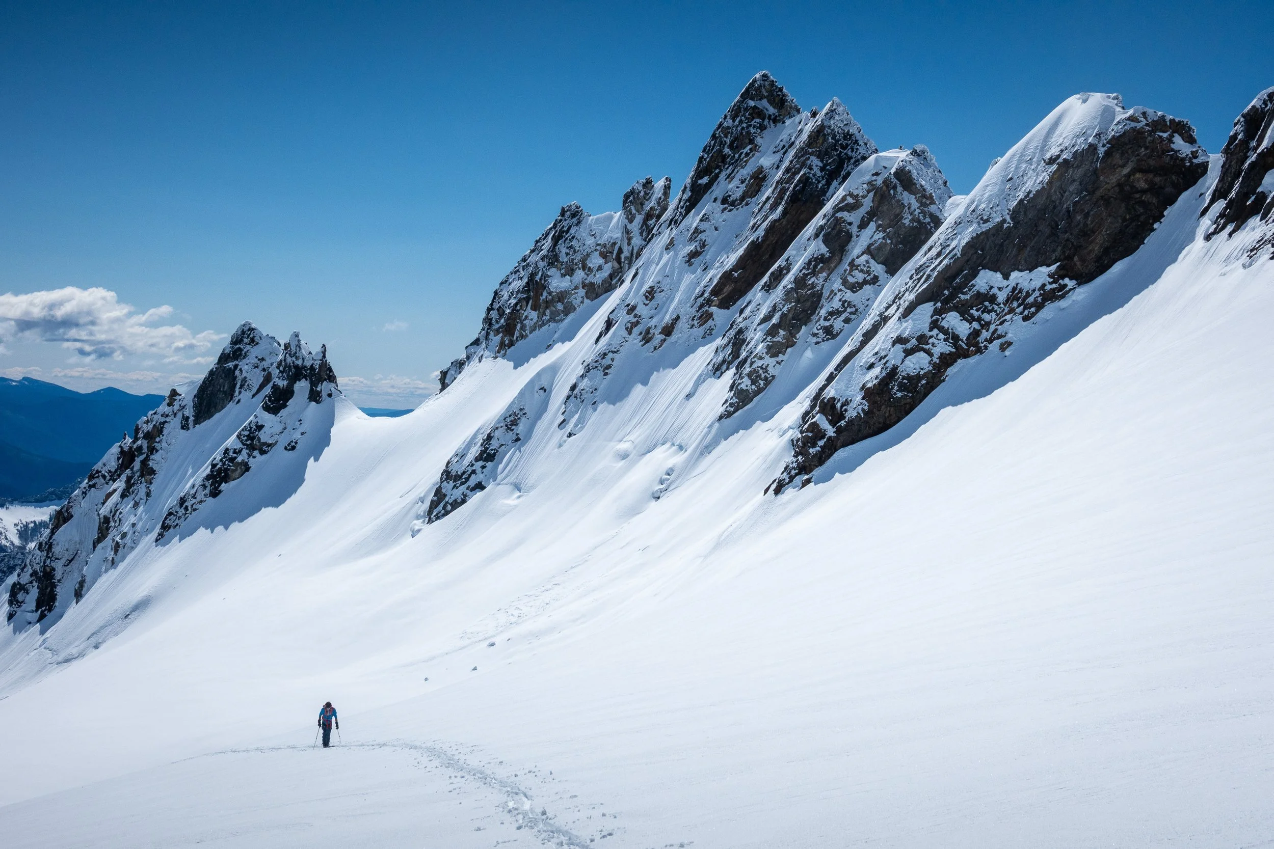
It was in this basin that we caught the owner of the tent back at Luna Col, and he followed us as we kicked steps across some mildly heads-up steep snow at 6,700 feet below the a steep rib of rock and onto the climbers’ right-hand lobe of the Fury Glacier east of the summit. We climbed more steep snow to where the glacier leveled off at 7,800 feet. From there, it was straightforward slushy cruising past the bergschrund and up the spectacularly exposed snow ridge to the summit of East Fury at 13:00, 3.75 hours from Luna Col. Unfortunately, with the warm weather and soft snow raising our loose-wet avalanche hackles, we opted to leave West Fury for the next trip, and dropped directly down the Fury Glacier (fun boot skiing and glissading on the skiers’ right line along the main lobe of the glacier this time instead of retracing our steps) to 6,700 feet, where climbed a short distance back to our up-tracks and repeated the steep snow traversing into the basin and back to the third hump. We got back to camp at Luna Col at 16:45, 3 hours after leaving the summit.
Morning light on Swiss Peak, Phantom, Crooked Thumb, and Challenger reflected in some ice along the shore of Luna Lake.
Matt and Eric traversing along the side of the “first hump” enroute to Fury, seen here at the right.
Eric and the Southern Pickets: Inspiration, The Pyramid and Degenhardt (separated by a band of snow reaching to the skyline) and Terror.
The final snow climb to East Fury was spectacularly exposed.
Matt demonstrating his excellent telemark boot skiing technique as he descends the Fury Glacier.
We lounged around at camp for a little while before heading up Luna. It was 30 minutes easy walking up the ridge to the false summit, then a few more minutes of easy, fun, and exposed scrambling to the true summit. We all enjoyed the views for a while, then the boys headed back to camp as I took my time descending, snapping lots of pictures of the sunset. I arrived back at camp just as the sun was dropping below the horizon, and we all enjoyed a few minutes of quiet as we watched it twinkle out of view.
Group photo on the (false) summit of Luna, with the classic view of the Southern Pickets.
Outrigger Peak
Day 4: I started our last day of the trip by running back up Luna to watch the sunrise, which was truly stunning. What an amazing place! A dragged my feet as I headed back to camp to make breakfast, then we set off at 8:15. Crampons ended up being unnecessary to descend the steep snow south of Luna Col, and before long we were saying goodbye to our views as the climbers’ trail deposited us at the top of the steep snow gully leading into Access Creek. A few minutes of excellent boot skiing and we were staring up at the impressive East Face of Luna towering above us. After some sunny boulder hopping we crossed from the right to left (looking downstream) sides of Access Creek at 3,800 feet or so. The climbers’ trail through the forest was in decent shape and pretty easy to follow, with a few sections of blow down, until we were almost at Big Beaver Creek. There, the trail petered out, but we found a high log to cross on without too much trouble. A hundred yards of bushwhacking later and we stumbled out onto the Big Beaver Trail just before 12, 3.75 hours from Luna Col including a lunch break.
It was a long hot hike out, and we didn't see a soul except for the trail crew from the Park service who had thankfully brushed and logged out the trail up to 2 miles or so from Access Creek. We reached Ross Lake at 16:00 and had plenty of time to jump in before our 17:00 water taxi pick up. Swimming felt amazing, and it was fun watching the lakeshore zip by from the water taxi. Neat views of Ross Dam made the hot trudge back up to Highway 20 manageable, and Eric and I said goodbye to Matt before setting out for the long drive back to retrieve my car.
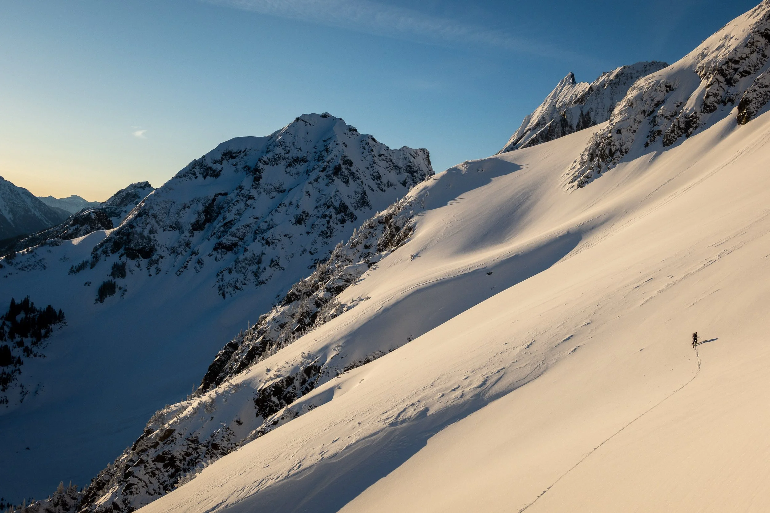
I even had enough time to photograph the sunset on Shuksan from Picture Lake on my big film camera, and skied Blueberry Chutes to tick off June turns before driving home.
First light hits the summit of Baker, with Phantom, Ghost and Crooked Thumb in front.
Southern Pickets panorama, with Outrigger Peak at right
A 7 minute self timer gave me plenty of time to scuttle from the true summit of Luna back to the false summit to snap this self-portrait.
Phlox and heather flowers along the Luna climbers’ trail made for a beautiful last view of the Southern Pickets before dropping down to Access Creek.
Crossing Big Beaver creek before the long hike down to Ross Lake