Over four days surrounding the 4th of July weekend Jaclyn, Helene, Adam, Becca, and I set out to complete the Ptarmigan Traverse, one of the most classic alpine high routes in the Cascades, and perhaps one of the most historic. Originally completed in 1938 (over 13 days!) by members of the Ptarmigan Climbing Club, the Ptarmigan Traverse heads south from Cascade Pass, in North Cascades National Park, into the Glacier Peak Wilderness approximately 20 miles to Spire Point, above the Suiattle River. The route stays high above treeline the entire way, and crosses several glaciers, high cols, and the hydrologic crest of the Cascades many times, passing by many of the most beautiful summits and lakes in the North Cascades. Despite the ruggedness of the terrain, the route itself is relatively gentle, making it one of the most popular and accessible high routes in Washington.
I had wanted to do this trip for many years, partially because it was one of my parents’ very first longer trips in the Cascades, back in 1989, and partially because my family had attempted it in 2012, when Adam and I were 17, but had turned around before the halfway point after my mom’s boots suffered a catastrophic failure. We had actually originally planned our trip for last summer, but were stymied by fire-related road closures on not one but both ends of the route. This year, though, we were in luck, and had a fabulous time with relaxed days, mostly beautiful weather, good conditions on the route, and enough time to tackle some objectives on the side.
Morning light on Dome Peak, the One Eyed Bull, and Spire Point as seen from our camp at White Rock Lakes, the most stunning campsite along the traverse and arguably one of the prettiest alpine lakes in the Cascades.
On Friday morning, after dropping my car up the Suiattle River Road, we set out up the Cascade Pass Trail’s many switchbacks, surrounded by dayhikers. The weather was glorious, and before long, we had left the crowds behind as we made our way up Mixup Arm towards the Cache Glacier and Cache Col, the southern boundary of the National Park. On the far side of Cache Col we descended towards Kool Aid Lake. On the hike down, by total dumb luck, I was able to locate the exact rocks my parents stood next to for a photo back in 1989, so we had to recreate the shot with Becca and I.
Heading up the margin of the Cache Glacier, with Forbidden and Sahale in the background.
My parents in 1989, with the Middle Cascade Glacier and Mount Formidable in the background.
Becca and I in the same spot in 2025. Note the recession of the Middle Cascade Glacier, partially obscured by the ridge coming down from Arts Knoll.
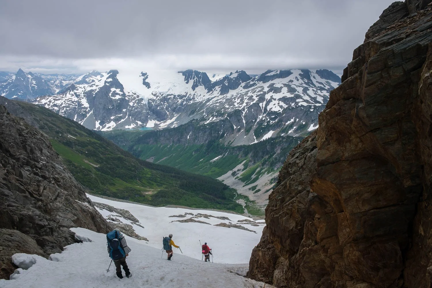
On the far side of Kool Aid Lake, we faced the infamous Red Ledges, which we needed to traverse to get onto the Middle Cascade Glacier. Reputation not withstanding, they were very mellow, and before long we were heading up the glacier towards the Spider Formidable Col, as clouds started to thicken and descend, obscuring many nearby summits. By the time we reached the col, we were only a few hundred feet below the cloud ceiling, and we found a pleasant place to camp just on the far side of the col on some glacial slabs. Before long, the clouds descended further, and we were in a complete whiteout, which made for a slightly chilly evening.
Approaching the Middle Cascade Glacier.
Becca and Jac nearing the Spider-Formidable Col, with clouds billowing around us.
Descending steep snow on the far side of the Spider-Formidable Col, with Sentinel, Old Guard, and Le Conte mountains hidden in the overcast.
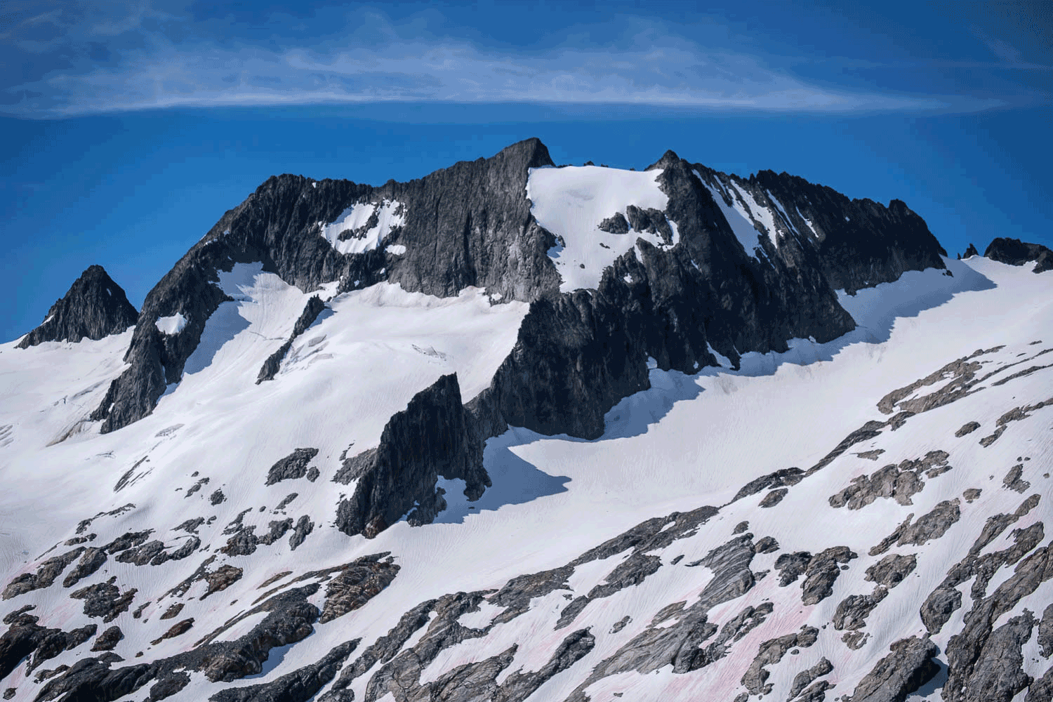
When my alarm went off at sunrise on Saturday morning, I had hoped for a clear morning, but I poked my head out of the tent to find that we were still very much stuck in a whiteout. At least this enabled some guilt-free snoozing, and after an hour or two, things began to burn off. After breakfast, the rest of the group set out to climb Formidable, while I headed in the other direction, hoping to climb Spider, having already climbed Formidable. Spider was not that pleasant, as Paul Klenke notes on Summitpost, but certainly far from the worst scramble I’ve done in the Cascades, and I was able to catch up the rest of the group just as they were reaching the summit of Formidable.
Sentinel and Old Guard above a little puddle near our camp.
The Flat Creek valley and clouds pouring over the Cascade Crest from high on Spider.
By the time we returned from our side mission(s), it was a bit later in the day than I had initially imagined, so we hoofed it down to Yang Yang Lakes and up a short snow gully to bypass Pt. 7004 and save ourselves a bit of distance. The stretch of the route along the ridge north of Le Conte mountain I thought was especially pretty, high on the ridge crest with views in all directions. It still hadn’t cleared up as I’d hoped, but it was a lovely afternoon walking along the Le Conte Glacier.
Becca and Jaclyn climbing steep snow above Yang Yang Lakes, with Formidable and Spider still shrouded in clouds behind them.
Traversing along the side of Le Conte, with the Le Conte Glacier in the distance.
Jac on the Le Conte Glacier, with Sentinel and Old Guard looming in the background.
After the Le Conte Glacier, the Ptarmigan crosses a small pass back onto the west side of the Cascade crest, and it was here that we got our first views of the South Cascade Glacier, the largest glacier on our route (albeit much smaller than it used to be). The South Cascade Glacier is one of the more extensively studied glaciers in the North Cascades, having been continuously monitored by the USGS since 1959. The USGS built a small cabin to host researchers on a ridge overlooking the glacier opposite the Ptarmigan Traverse’s route, and as luck would have it, when we got our first views of the glacier, the sun had just broken through the clouds and lit up the whole scene with backlit sunbeams, a lovely panoramic sight. In the late day light we traversed above the glacier before descending onto it, then crossed the glacier to reach the col above White Rock Lakes. White Rock Lakes is a spot I had always wanted to visit, having gotten skunked in 2012, and it has one of the most stunning views in the Cascades, looking across Agnes Creek to Dome Peak, the Chickamin Glacier, the One Eyed Bull, Spire Point, and several other summits. We descended snow from the col towards the lakes late in the day, with great light and some swirling clouds on the summits to add drama. This evening’s hike was one of my favorite moments of the trip.
Helene above the South Cascade Glacier and lake. If you look carefully in the middle of the frame, on the ridge on the far side of the glacier, you can see the USGS monitoring station.
Traversing the western slopes of Le Conte towards the South Cascade Glacier. Our route goes across the low col in the middle of the frame, below the Dana Glacier, the One Eyed Bull, and Spire Point.
Descending towards White Rock Lakes. Dome Peak at left is the tallest summit in the area, and the One Eyed Bull and Spire point are to the right.
For me, White Rock Lakes lived up to my expectations, with beautiful flowers, heather, and 10/10 views. Definitely my favorite of our three campsites on the traverse. I spent the whole evening and the following morning running around snapping pictures and enjoying the scene.
Lenticular clouds over Gunsight at sunset.
The view from the outlet of White Rock Lakes, looking across Agnes Creek to Gunsight, Sinister, Dome, the One Eyed Bull, and Spire Point.
Not wanting to leave, we got a veeerryyy relaxed start Sunday morning, delayed in part by a disagreement amongst the group: By now, I’ve mentioned several times the One Eyed Bull, the summit immediately across the Agnes Creek valley from White Rock Lakes. We all knew where the summit was, but the bull itself was less obvious. Two competing interpretations developed. I saw an entire bull, with the head to left, seen in profile, while Jaclyn saw just the head of the bull, looking straight at the viewer. We’d really appreciate your help resolving this point of contention. Take a look at the picture below and let me know if you’re on Team Galen or Team Jaclyn!
My artistic interpretation of two possible One Eyed Bulls, masterfully sketched. Wait a second for the animation to loop around to see them!
Eventually, we left White Rock Lakes and started descending into the Agnes Creek valley, climbing up onto the Dana Glacier. Here we left the standard Ptarmigan route and headed further east, directly to the top of the Dana Glacier to the Dome/One Eyed Bull Col, which provided more direct access to the Dome Glacier and Dome Peak, our climbing objective for the day. After a lunch break, we left our overnight gear and climbed up to Dome. The final few yards to the true summit of Dome requires an easy but very airy and exposed traverse along the ridge, which got some good giggles out of everyone.
Descending from White Rock Lakes into the Agnes Creek drainage to reach the Dana Glacier (to the left of the frame).
Approaching the Dana Glacier, with Elephant Head at left.
Becca, Helene, and Jac on the airy traverse to Dome’s summit.
After enjoying the views from Dome, we eventually descended back to our overnight gear, and headed down to Itswoot Ridge, our final campsite, with amazing views of Glacier Peak across the Suiattle River valley. We were treated to a truly gorgeous final sunset from our campsite on the heather ridge, and I had a lot of fun photographing nearby waterfalls.
Passing a neat meltwater pond on the way to Itswoot Ridge, with Glacier Peak in the background.
Group photo at Istwoot Ridge.
Glacier Peak, Itswoot Ridge, and the Sulphur Creek valley at dusk.
On Monday morning we woke up and packed up for the hike out to the Suiattle. From Itswoot Ridge we descended to Cub Lake, which beautifully frames Glacier Peak, surrounded by flowers. After a short uphill, we crossed into the Bachelor Creek drainage dropped below treeline for the first time since below Cascade Pass. We were thankful to have recently-maintained climbers’ trail through the slide alder along Bachelor Creek, and before long, we were on the official trail paralleling Downey Creek. Here we ran into a trail crew doing an amazing job clearing blowdown - thanks! The final 6 miles out to the car dragged on just the right amount of too long, and we took a quick dip in the Suiattle to get the dust off before driving home. An amazing trip!
Glacier Peak and Cub Lake.

Thankful for good trail through the slide alder along Bachelor Creek.