Two weeks ago, I headed out with Matt and Anton to climb Bears Breast Mountain, a spiky peak right on the Cascade Crest in the heart of the Alpine Lakes Wilderness. Bears Breast had intrigued all three of us: it was one of the few summits Anton hadn’t climbed along the jagged ridge running from Snoqualmie Pass all the way to Mount Daniel. Matt and I had both separately looked over at Bears Breast from Hinman and Daniel earlier this summer, and it looked like a fun climb. Bears Breast is also notable for an unusual geologic feature: its southeast face holds a clean and continuously steep sandstone slab that stretches about 3,000 vertical feet from the base of the mountain at Shovel Creek all the way to just below the summit. This is one of the taller slabs in the lower 48, and there’s also very little sandstone in the Cascades, so it seemed like a doubly cool route to take to the summit.
We planned to climb in a single day. It’s a long way in to Bears Breast, no matter which way you come in, but we decided to come in along the Waptus River from Salmon La Sac, with 12 flat miles one way to reach the base of the mountain. After one last practice talk for my defense, I drove out to Cle Elum to link up with Matt and Anton, and we camped at the trailhead for an early start. We started hiking about an hour and a half before first light. The approach went pretty quickly in the dark, and we had a lovely sunrise somewhere along the river valley. Just after it got light, we startled a rabbit on the trail, which ran towards us, smacking into each of our feet in turn, then it turned around and smacked back into us on the way back. I think I was more startled than the rabbit!
Matt managing to keep his feet dry crossing the Waptus River, with some wisps of fog clinging to the water in the chilly morning.
We reached Waptus Lake just as the morning light was lighting up a nice view of Bears Breast through the hazy sky. The handful of parties camped near the lakeshore were just about the only people we saw all day. We continued around the lake to hit the PCT, then continued a few miles further to the bridge over the Waptus River before leaving the trail and following the east side of Shovel Creek.
The Cascade Crest from Waptus Lake, with Summit Chief, and its subsummits on the left, and Bears Breast looking spiky on the right.
An annotated view of our route up the mega-slab from the forest near where we left the PCT.
It took a bit of bushwhacking, but eventually we picked up a faint-in-places fisherman’s trail heading up towards Shovel Lake. On the way out, we realized that a more-defined trail leaves the PCT earlier than we had, where the trail makes a defined turn to the west about .4 miles before it hits the Waptus River. We followed the trail through open forest until it started climbing up onto a bench above the east side of the creek around 3,400 feet. When the bench ended, we dropped fifty feet out of the forest and into talus near the creek. Here the tread disappeared into the rocks, and we just boulder-hopped easily through open terrain to reach the base of the slabs, stopping to fill up water. It was a beautiful morning with fall colors in the forest. We reached the base of the slab at its lowest point a bit before 10am, about 4.5 hours after leaving the car.
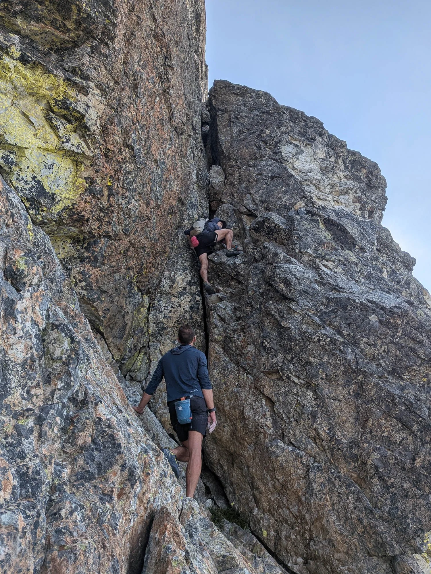
Anton and Matt near the base of the slab, summit far above.
We started climbing up the broad slab—it seems like it goes pretty much everywhere. The climbing was super fun and easy, and we did the whole thing in trail runners, only using our hands in a few spots. The scale of the terrain is huge. The slab is hundreds of yards wide, with a massive corner on the ridge, and only a few patches of vegetation. The only shame was how quickly the climb went by. After about an hour and twenty minutes we topped the slab out on the south shoulder of Bears Breast, about 600 vertical feet below the summit, with great (albeit hazy) views to the south.
Matt climbing low on the slab
Can you spot Anton?
Easy walking a bit higher up
Waptus Lake poking out as we near the top.
From the top of the slab, we needed to traverse around the west side of the mountain to reach the base of the easiest route up the final summit block. Rather than dropping a hundred feet to cross a gully, we traversed on some exposed scrambling up high, then walked up an easy heather bench for ~300 yards to reach the notch in the ridge immediately north of the summit. We dropped packs here, changed into rock shoes, and soloed up to the summit, accidentally making things a bit trickier by going too far climbers left at the start. When on route, the climbing was pretty easy but exposed and on chossy rock. The chimney itself was super fun, and it was easy above it to the true summit at 12:20.
Easy heather benches traversing to the notch north of the summit block.
Anton and Matt just below the chimney, with additional breasts (nipples?) in the distance.
Matt tackling the bottom of the chimney.
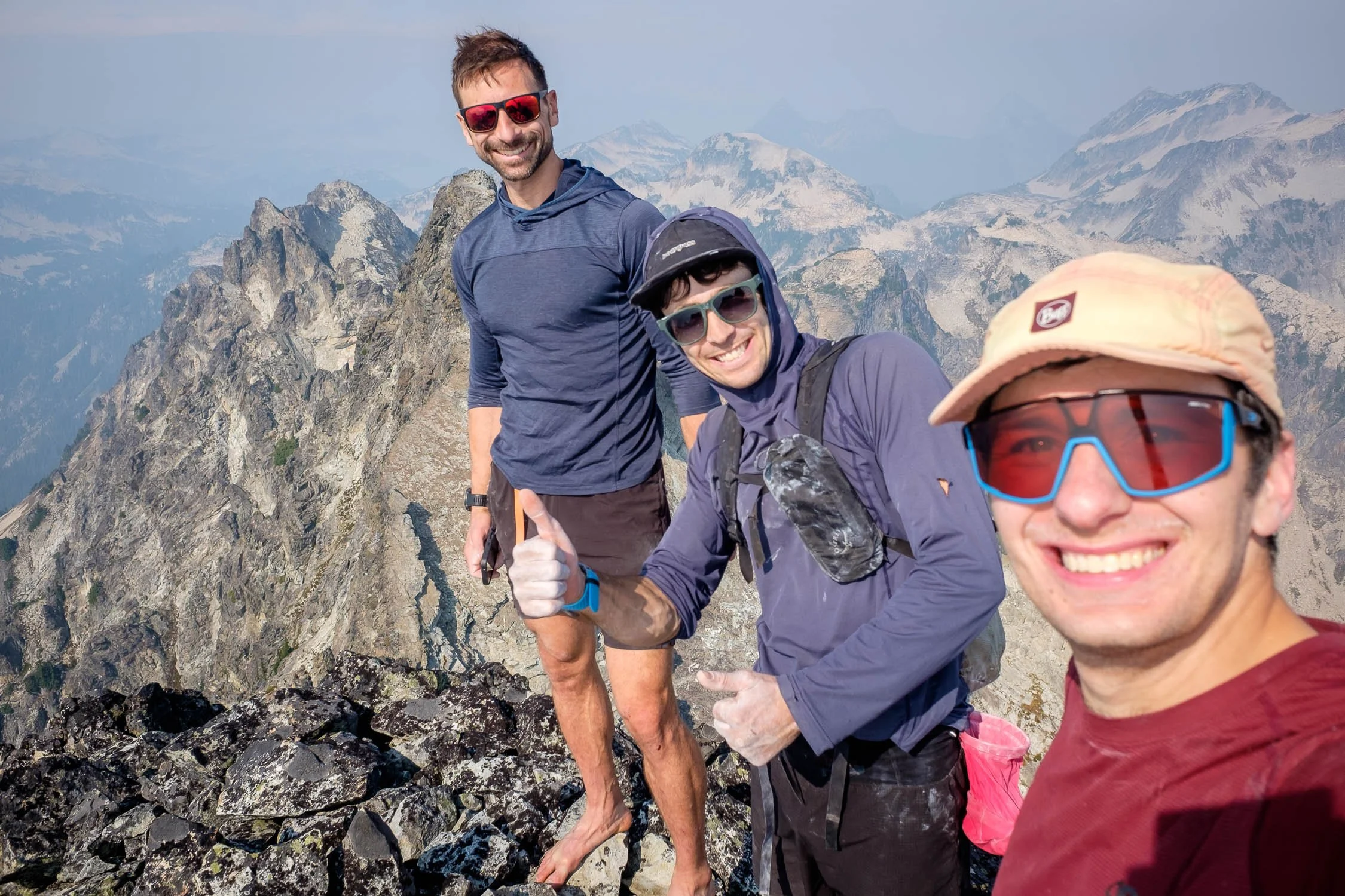
Summit selfie—-Hinman to the right.
We downclimbed without any trouble, staying on easier terrain below the chimney than what we’d come up. It was nice to have rock shoes, but we didn’t feel like we needed the bit of rope we’d brought. We descended pretty much directly to Shovel Lake, descending loose dirt up high (would be more pleasant with snow earlier in the season) then lovely open slabs, then brush and cliff bands (moderately unpleasant) down low to reach Shovel Lake. It took us 1.5 hours from the base of the summit block to the lake, and I’m sure micronavigational optimizations could make this easier/faster.
Matt facing his nemesis: steep loose dirt.
Matt downclimbing dirty cliff bands above Shovel Lake
Bear tracks along the shore of Shovel Lake.
Once at Shovel Lake, we traversed around the shoreline then downclimbed the western side of the outlet (east goes too) then boulder-hopped down the valley (I don’t think there’s much of a trail here) until we were back at the base of the slabs where we’d filled water earlier, where I managed to break one of my brand new trekking poles. We picked up the trail as it climbed up to the bench, the followed it easily back to the PCT. Once on the official trail, we ran most of the many miles back to the car, which were surprisingly deserted. We reached the trailhead a bit before dark, and took a nice jump into the swimming hole before heading back home.
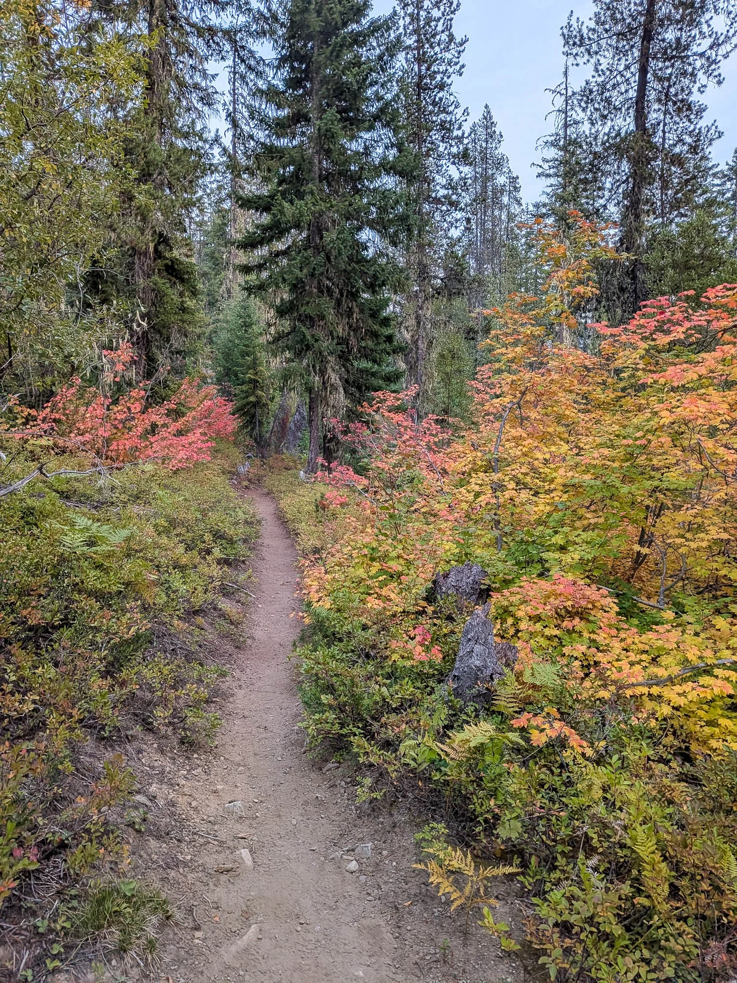
Nice fall colors along the Waptus River Trail for our run out.
This was a super fun climb that I think should get done more often - the first ascent was in 2005 and only about 7 or 8 parties have reported doing it in the summit register since then. Bears Breast as a whole seems to only get about 1 party per year. Matt liked the climb so much he went back and did it again the next weekend! And it’s worth noting that he just descended the ascent route up the slabs rather than messing with the route down to Shovel Lake. He said he preferred this strategy.