Twoish weeks ago, Helene and I snuck out for a little mid-week excursion to climb Whitechuck Mountain, the northernmost of a chain of spiky summits that extends from the Monte Cristo group to the Suiattle river. Whitechuck has many logging roads on it, meaning you can drive to almost 5,000 feet, making it an ideal quick climb with easy access and great views (assuming clear weather, an assumption that didn’t entirely hold for us).
We set out from Seattle just past 5pm on Monday evening, cognizant of the earlier and earlier sunsets as we cruise towards autumn. After bumping our way up Forest Service Road 2435, we started hiking with just an hour of daylight left, and just a few hundred vertical feet of clearance between us and a thick cloud ceiling above us.
Helene inspecting the remotely-operated snow height gauge and weather station installed by the Northwest Avalanche Center.
We hiked along the crest of the gentle Northwest Ridge of Whitechuck. With the clouds just above us, there was a brief but dramatic sunset, with the bottom of the clouds glowing orange through the trees. The views from the ridge were lovely, and before long we dropped off the ridge as it steepened and entered the talus basin to the west of the summit. Here we made a brief detour from the climbing route, hopping talus to find a small tarn that I hoped would make for a pleasant campsite and nice views at sunrise. Darkness fell as we climbed into the clouds, and our headlamps illuminated beams of fog. We found the tarn and a nice place to camp, quiet in the clouds, and I fell asleep hoping we wouldn’t be too socked in in the morning.
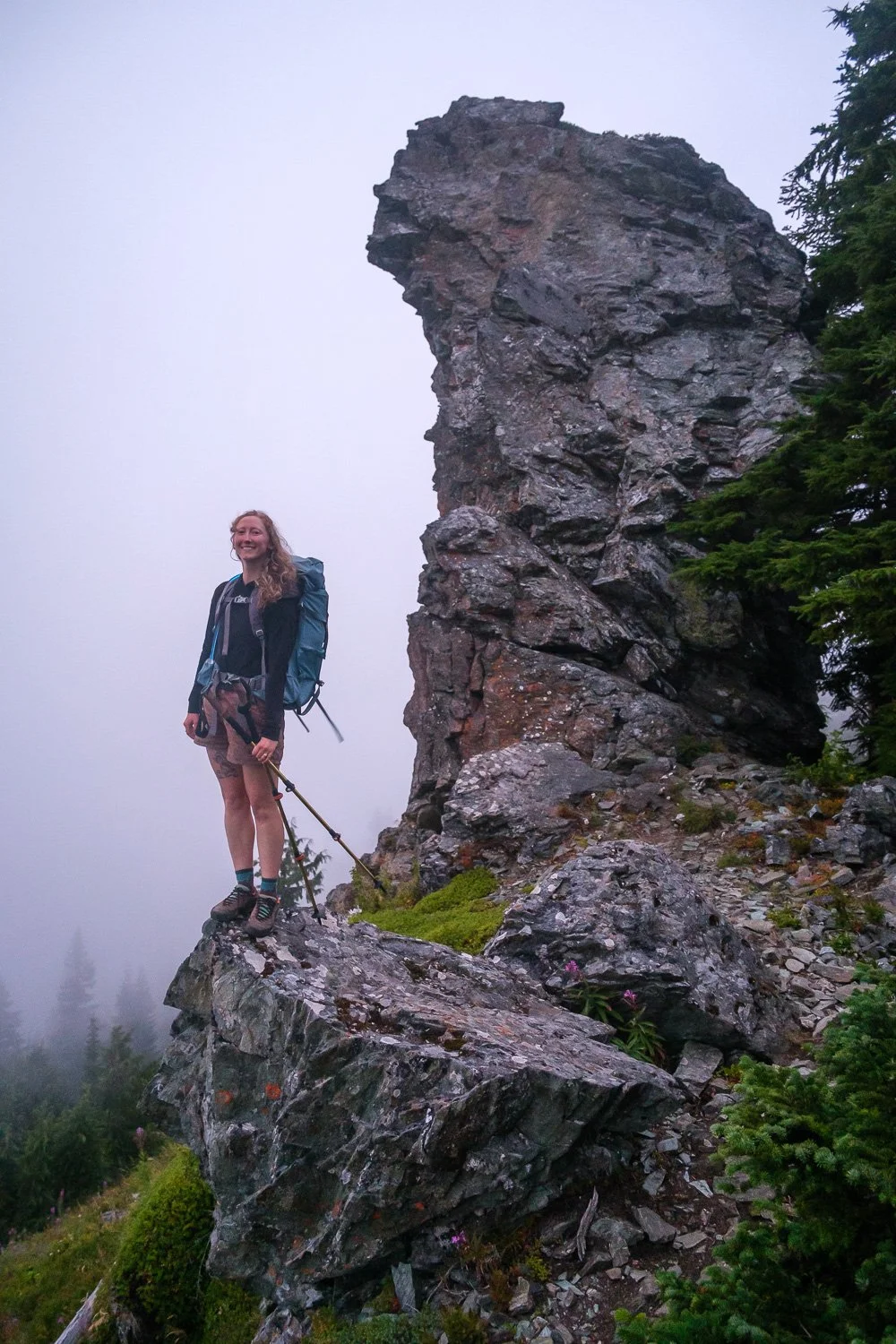
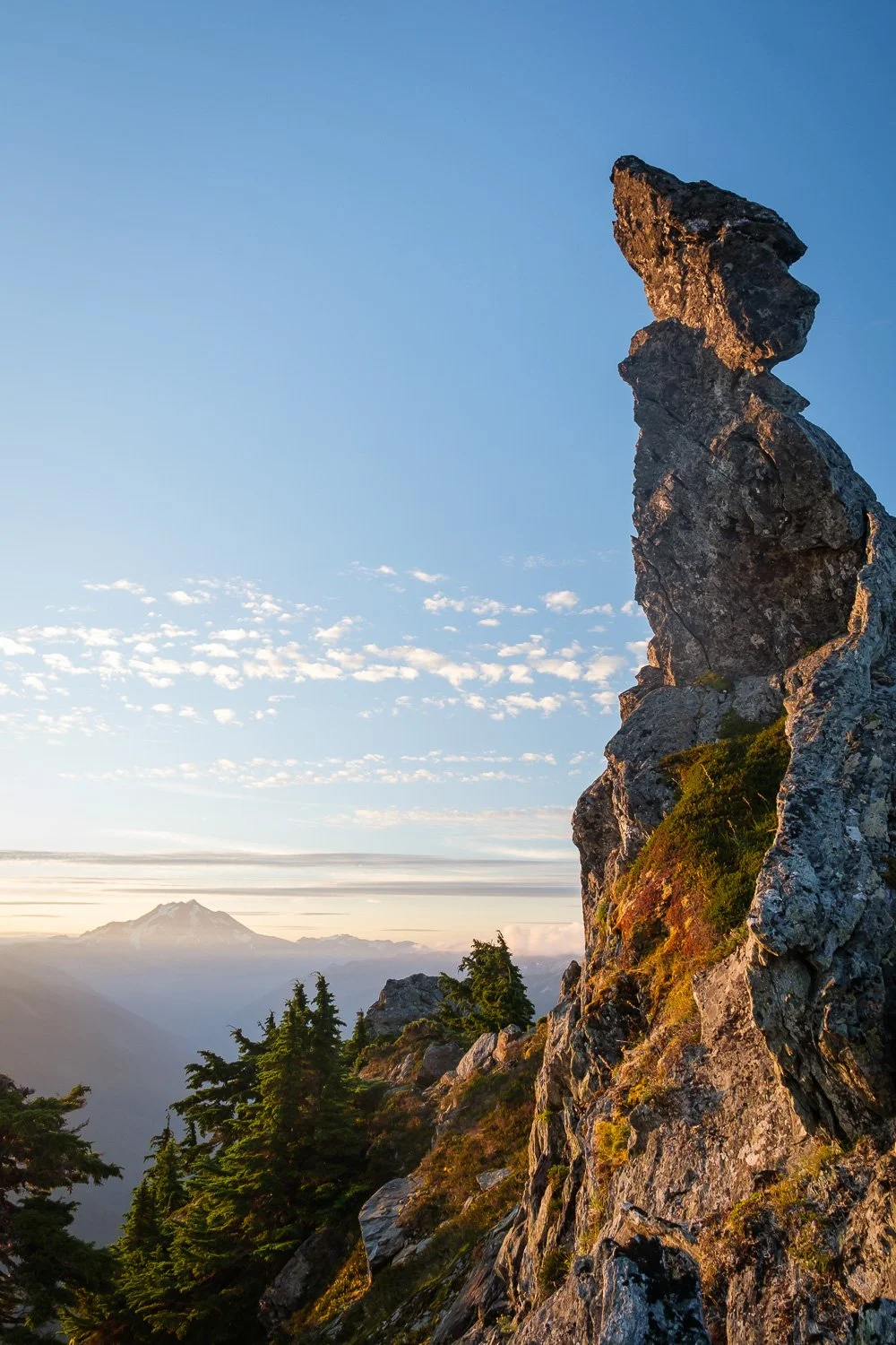
Helene and a cool rock outcropping along the NW ridge trail.
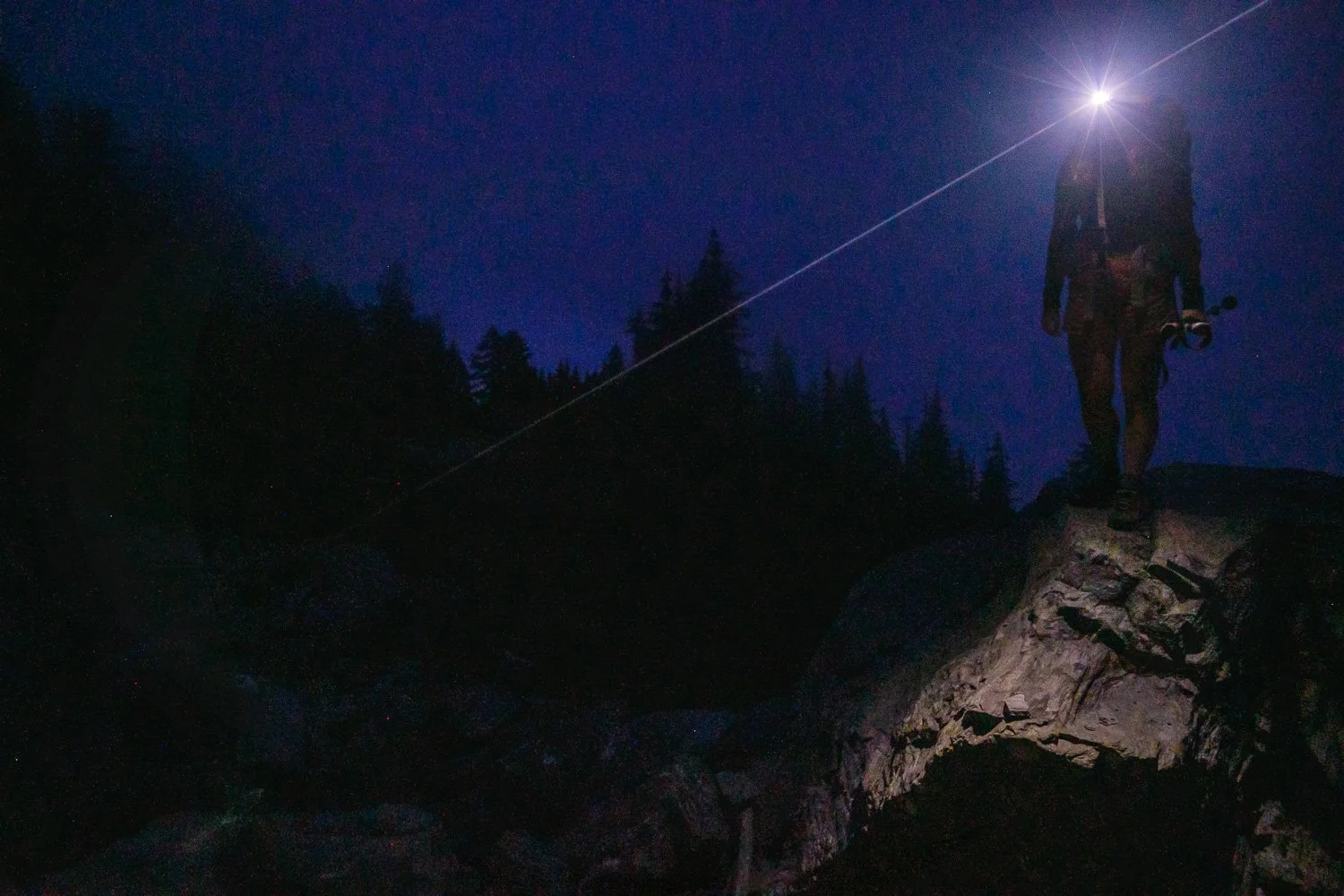
Boulder hoping by headlamp on the way to our campsite.
We woke up to a beautiful, crystal clear dawn, with a few lingering blobs of clouds hanging around the summits to the south. We had a fun time scampering around taking photos and finding not only a few mountain goats, but a few game cameras placed by the Tulalip Tribe to track said goats.
Pugh and Sloan Peak at dawn, with the Monte Cristo summits partially obscured by trees at the right.
Dorado Needle and Eldorado to the northeast, an intriguing angle.
Glacier Peak to the east, with a cool rock pinnacle on Whitechuck’s SE ridge in the foreground.
The 10-second self-timer strikes again - despite Helene’s assistance I wasn’t quite fast enough.
Second time’s the charm for this self-portrait of Helene and I, with Pugh in the center of the image, Sloan looking spiky to the right, and the Monte Cristo Peaks to the right of that. Forgotten Peak closer at far right, with Del Campo and Rainier faintly visible behind it.
We returned to camp and packed up, then made our way back to the climbers’ route up Whitechuck, much quicker going in the daytime. We dropped our overnight gear at the base of the gully descending from the saddle between the NW and main peaks, and started climbing. Despite being quite spiky, the standard route up Whitechuck is mostly a walk-up with a few spots of very easy scrambling. As we climbed, clouds built over the summit above us, and pretty soon we climbed up into them, making for an atmospheric final scramble to the true summit.
This ground squirrel was enjoying salad for brunch. Thanks to everyone who responded to my last email with helpful pointers on rodent identification!
Helene on the way up Whitechuck, with the Northwest Summit to the left, and Baker and Shuksan visible in the distance.
Climbing up into the clouds
Whiteout on Whitechuck! Here Helene cruises the last “crux” just below the summit.
Descending the flower-filled gully on our way back to the trail.
Despite the lack of mountaintop views, we had a grand time filling out the summit register before heading back down to the trail, cruising back to the car, and blasting straight to work.